
Tofindtheenchantedislands,leavemainlandEcuadorandtravelwest.FollowtheEquatortoapatchofsea.Thereyouwillfindanisolatedclusterofislands,the Galápagos.
Someislandslooklikegreengemsontopoftheocean.Otherislandslookbarren.Thereare13largeislands(12shownonourmap),six smallerones,andlotsofrocks.Howdidtheyform?Let’sfind out.
FromtheDepths
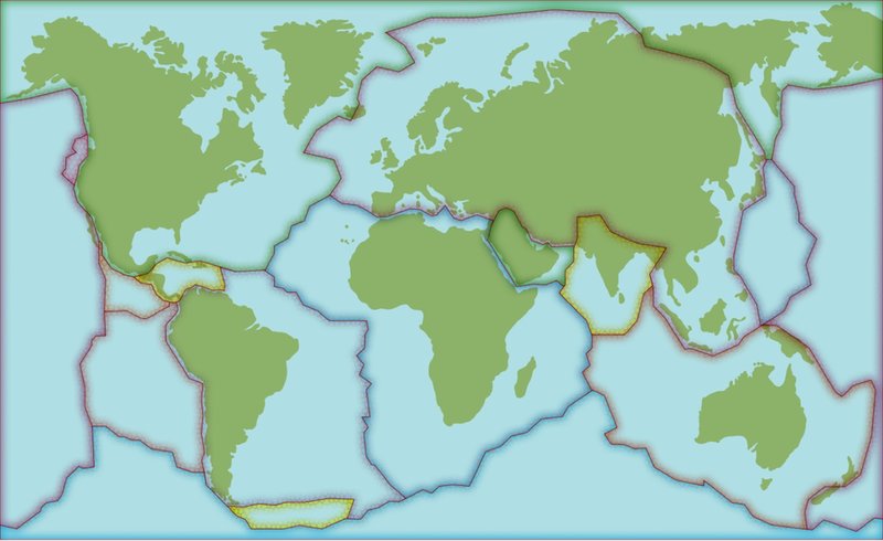
TheGalápagosIslandssitontopofanactivevolcanicregion.TheislandslieontheNazcatectonicplate.Thisistouchedbyfourother plates.
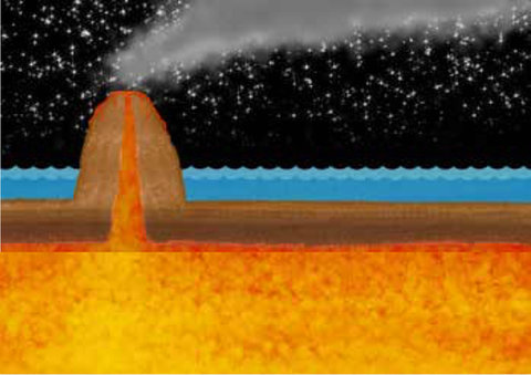
Here,thereisahotspotinEarth’scrust.Acolumnofhotmagmarises.Itreachesthesurface.Thenlavaspewsoutandpilesup.Avolcanoforms.Thisishowthefirstisland,Española,formedlong ago.
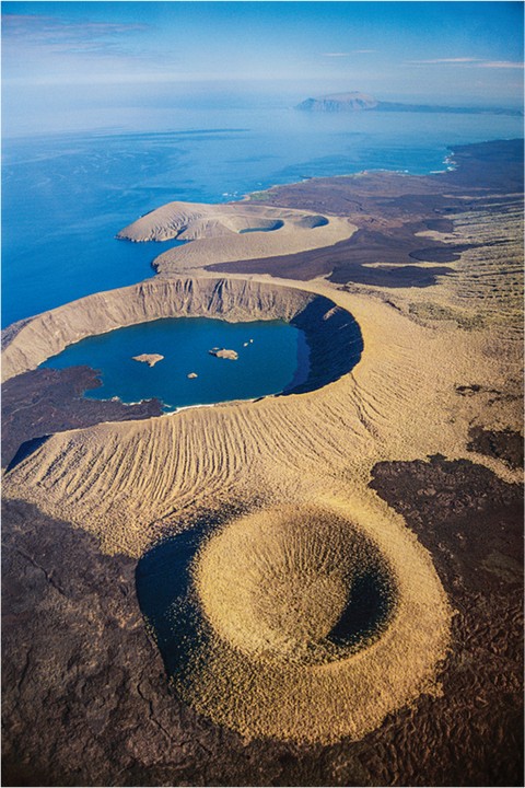
ThisviewfromaboveshowsthevolcaniccratersthatmakeupIsabela Island.
OntheMove...
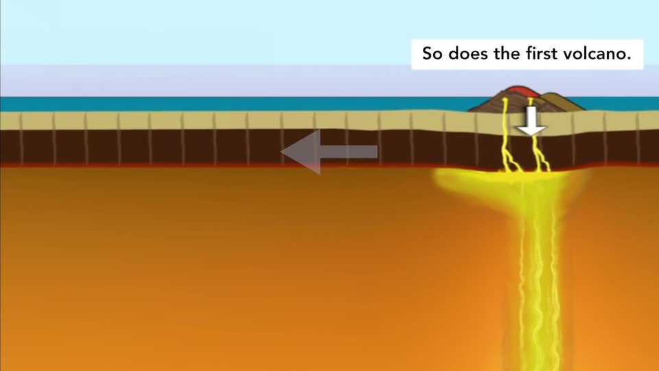
Volcanicactivityexplainshowoneislandformed.Butwhatabouttheotherislands?Tectonicplatesmove.Yet,thehot spotdoesnot move.
Overtime,EspañolawascarriedsoutheastwardalongwiththeNazcaplate.Thenanewisland,SanCristóbal,formedonthehot spot.Astheplatecontinuedtomove,moreislandswere created.
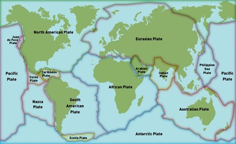
mapofEarth'stectonic plates
...Over Time
Inamillionyears’time,theislandFernandinawillhavemoved60 kilometers(37miles)southeast.Newislandswillforminits place.
MovingIslands
IttookmillionsofyearsfortheGalápagosIslandstoform.AstheNazcaplatemoves,newislandsformoverthehot spot.Oldislandsfallawayintothe sea.
Beforeyou read

EarthScience
NaturalProcesses
North
American
Plate
Eurasian Plate
Antarctic Plate
Australian Plate
Philippine
Sea
Plate
Pacific
Plate
Pacific
Plate
Nazca
Plate
South
American
Plate
African Plate
Caribbean
Plate
Arabian
Plate
Indian
Plate
Juan
deFuca
Plate
Cocos
Plate
Scotia Plate