
Tofindtheenchantedislands,youmustleavemainlandEcuadorandtravelwestfor1,000kilometers(620 miles).FollowtheEquatortoapatchofsea.Thereyouwillfindanisolatedclumpofislands,the Galápagos.
Fromtheair,someislandslooklikegreengemsatoptheblueocean.Otherislandslookbarren.Thereare13largeislands(12shownonourmap),six smallerones,andscoresofunnamedrocks.Howdidtheseislandsform?TheanswerliesinthelargeplatesthatmakeupEarth’s crust.
FromtheDepths
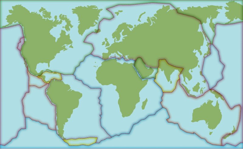
TheGalápagosIslandssitontopofoneofEarth’smostactivevolcanicregions.TheislandslieontheNazca tectonicplate,whichistouchedbyfourother plates.
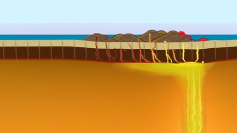
Thisplacerestsabovea hot spotinEarth’scrust.Here,acolumnofhotmagmarises.Whenitreachesthesurface,lavaspewsoutandpilesup.Eventually,avolcano forms.
ThisishowthefirstGalápagosisland,Española,formedmorethanthreemillionyears ago.
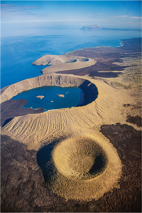
ThisaerialviewshowsthevolcaniccratersofIsabela Island.
OntheMove...
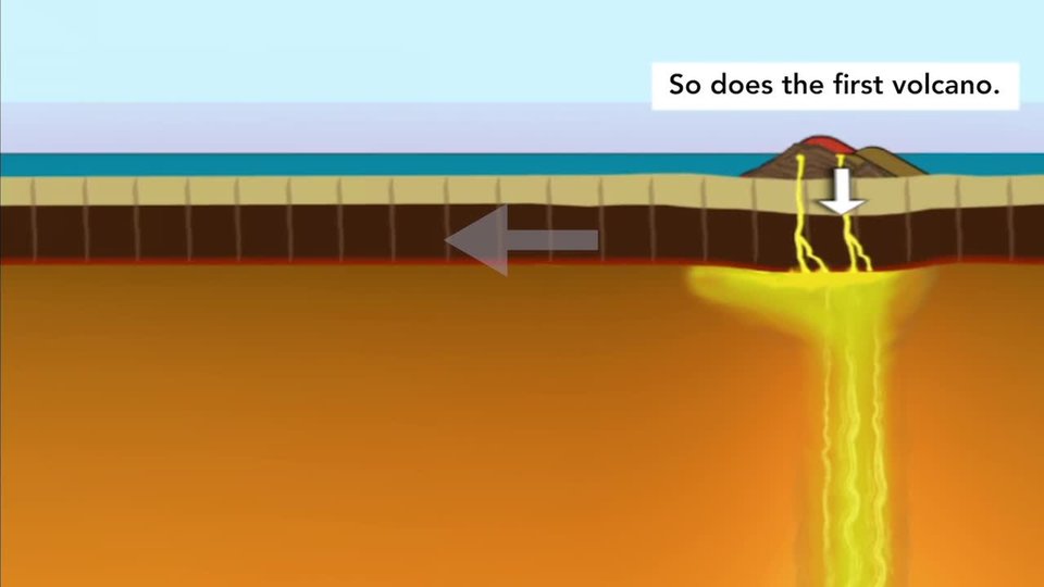
Volcanicactivityexplainshowoneislandformed.Buthowweretheotherislandsformed?Tectonicplatesmove.TheNazcaplatemovestowardtheSouthAmericanplateataround7 centimeters(2.7inches)per year.
Thehot spotdoesnotmove.Overtime,Españolawascarriedsoutheastwardalongwith theNazcaplate.Thenanewisland—SanCristóbal—formedonthehot spot.Theislands’layoutreflectsthespeedanddirectionofthemoving plate.
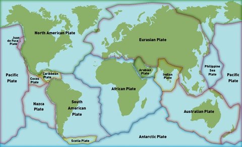
mapofEarth'stectonic plates
...OverTime
Inamillionyears’time,theislandFernandinawillhavemoved60 kilometers(37miles)southeast.Newislandswillhaveformedinitsplace.Theeasternislandsareall older.
MovingIslands
IttookmillionsofyearsfortheGalápagosIslandstoform. AstheNazcaplatemoves,newislandsformoverthehot spot.Oldislandsfallawayintothe sea.
Beforeyou read

EarthScience
EarthMaterialsandSystems
North
American
Plate
Eurasian Plate
Antarctic Plate
Australian Plate
Philippine
Sea
Plate
Pacific
Plate
Pacific
Plate
Nazca
Plate
South
American
Plate
African Plate
Caribbean
Plate
Arabian
Plate
Indian
Plate
Juan
deFuca
Plate
Cocos
Plate
Scotia Plate